You can fly to Gilgit from İslamabad or take the road. My two friends and I chose the road though it is a long one because flights to Gilgit are very much dependent on the weather which can change very quickly in this mountainous region even in the summer, and because we wanted to see the ''8th Wonder of the World''. İt was a good choice since we also saw what rural Pakistan looks like.


It is impossible to reach Gilgit in one day so we spent the night in Becham and the next day we were on the ''8th Wonder of the World'', the Karakoram Highway ( or Friendship Highway), KKH as is commonly called. İt is just a road, but not a normal road.
The Karakoram Highway, one of the greatest engineering achievements of the 20th century, connects Pakistan's Gilgit - Baltistan region with the Xinjiang region of China (ending in Kashgar) across the Karakoram mountain range , through the Khunjerab Pass, at an elevation of 4.693 m. KKH has a total length of 1.300 km of which 887 km are in Pakistan and 413 km in China. It was started in 1959 and completed in 1986 after 27 years of construction. 24.000 men worked here and 810 Pakistani and 82 Chinese workers lost their lives mostly in landslides, mud slides and falls during construction. Even after its construction, KKH continues to require heavy maintenance.
The KKH is mostly asphalted and is considered to be the highest paved international road on the planet. İt is also considered one of the world's hardest alpine climbs . KKH is very treacherous because it has been cut into sheer rock through the highest and mightiest mountains of the world, the Karakoram and the Himalaya chains, and landslides, avalanches and flash waterfalls after heavy rains are quite common occurrences and this in summer months. We have seen them all.
 |
| KKH İS LİTERALLY CARVED İN ROCK |

 |
| REMNANTS OF AN AVALANCHE - WE WERE LUCKY TO HAVE WAİTED ONLY AROUND ONE HOUR FOR THE ROAD TO BE CLEARED BECAUSE WE HEARD OF PEOPLE BEİNG STRANDED FOR ONE WHOLE DAY. |
 |
| NO LANDSLİDE YET BUT CAN HAPPEN ANY MOMENT FROM THE LOOK OF İT. |
 |
| AND İT HAS. |
 |
| İT İS RAİNİNG TODAY AND WE PASS UNDER WATERFALLS. |

The KKH is a very steep road climbing up one side of the mountain of a very deep gorge. So it abounds in twists and turns with wheels sometimes hanging above the precipice. With absolutely no barrier on one side and a sheer rock wall mountain with high risk of rockfalls on the other, the margin for driver error is very slim. Furthermore, it is very narrow at some points, enough for only one jeep. When another jeep is coming from the other direction, the drivers need to find a wide enough area where the two jeeps can fit at the same time. And one jeep is always very close to the precipice. We are talking of a very steep fall of some hundreds of meters. KKH is definitely not for the faint of heart and is an adrenaline-pumping journey. But at the same time it is breathtaking. Words cannot describe KKH and pictures do not do it justice.


Strange things also happen on KKH. At one place, in the middle of nowhere, we saw a guy selling barbecued corn. As it was raining he had taken shelter under a rock, put up his fire and was busy roasting. The traffic here is pretty light. Who is he going to sell to? Where did he come from (rocky mountains everywhere) ? A total mystery.


 |
| WE TRAVELLED A LONG WAY WİTH THOSE CHİCKENS |


The valleys among the rocky mountains are very beautiful, perhaps more so under the rain.


Let us have lunch at a village on the road. İt started raining really hard.

 |
| THE ADVANTAGE OF BEİNG ONLY THREE PEOPLE İS THAT YOU CAN EAT ALMOST ANYWHERE. |
 |
| I DO NOT KNOW İF THE CHİCKEN I ATE WAS ONE OF THOSE. |
 |
| OTHER RESTAURANT GUESTS. |
It was not in this restaurant but in another one where the menu kind of repulsed me (I hate snakes) but made me laugh at the same time .


We are now approaching Gilgit and we are following the Gilgit river. The scenery changes every second. Little villages perched among green hills, then all of a sudden a desert and then another village in something like an oasis. You really can't take your eyes from your surroundings since the landscape at every turn is stunning but we are in one of the most inhospitable areas of Pakistan.


The evening approaches and we are still on the road among these arid lands. And all of a sudden rocks give way to snow and an incredible sight.


We are at Nanga Parbat viewpoint. Nanga Parbat, in the Western Himalayas, is Kashmiri for ''Naked Mountain'', called so because its slopes are barren, with no vegetation at all. It is 8.126 m high, which makes it the 9th highest peak in the world and the 2nd in Pakistan after K2. İt is referred to as ''Killer Mountain'' as it has claimed the lives of many climbers before being conquered by a German-Austrian joint expedition in 1953.It is considered the second hardest 8.000 m mountain climb after K2.
Nanga Parmat is a truly awesome spectacle for me. I am mesmerized.


 |
| EVEN FROM THİS FAR AWAY, YOU CAN SEE THE GLİSTENİNG OF THE GLACİER. |


This is also the confluence point of the Gilgit and Indus rivers.

We are in Gilgit to spend the night. We have no time to visit Gilgit now so we continue the next morning towards Karimabad, the capital of Hunza Valley, which was a princely state in British India and then independent Pakistan until 1974 when it was dissolved by Zulfikar Ali Bhotto. I had been an independent principality for more than 900 years, ruled by a prince called traditionally ''Tham'' (ruler). The first seat of government of the former Hunza state was Altit. Later it shifted to Baltit (modern-day Karimabad ) called after Karim Aga Khan, the spiritual head of the İsmaili community.
Hunza has an identity quite independent from the rest of Pakistan. With respect to their neighbours, the people of Hunza are highlighted by an appearance very similar to that of Europeans with light skin color and very often green eyes. Even though they all know Urdu, they speak a unique language called Burushaski unrelated to any other. And they are mostly Ismailis while the rest of the country is largely Sunni. The Ismailis are Shiite Muslims who believe that the true 7th Imam was Ismail rather than his younger brother Musa as the Twelver Shias of Iran believe. Their spiritual leaders are the Aga Khans and this family is sadly uncommon in being a spiritual leader who also looks after his followers' material well-being. Due to the efforts of the Aga Khans, the Ismailis have become one of the most progressive of Islamic sects.
Hunza and its environs are also renowned for something else that is quite extraordinary : at least 90% of the people in the valley - and virtually all the youths of both gender- can read and write and this in a country where about 45% of the population is illiterate and millions of girls do not attend school at all. Almost every child in Hunza attends school up to at least the high school level, while many pursue higher studies at colleges in Pakistan or abroad. And the main factor behind Hunza's formidable literacy rates traces back to the educational efforts of Aga Khan III.
The importance of education has raised the status of women to equality with men. As a result of this, in the Hunza Valley, it is common to see local women out living their lives, interacting with you the tourist whereas just a couple of hours south it is essentially impossible to even see a woman in public, public life being the exclusive domain of men. Here women are an integral part of the local economy.
One other striking aspect of those people is said to be their extraordinary ability to stay forever young and healthy. This is believed to be due to the fresh air, the altitude ( the valley starts at 2.500 m and goes up to 3.500 m) and the healthy , natural food they consume. Terraces line the slopes at the foot of the mountains and this is where the Hunza people grow their food. The Hunza apricot is well-known but almonds, walnuts, apples, peaches, cherries and even some grapes are grown in the valley. The fields bear mostly grain, potatoes but also very many kind of vegetables. Some of the above are dried during summer months and constitute a healthy food in the winter.


We are driving towards Karimabad when another majestic mountain greets us - the Rakaposhi towering at 7.788 m. The mountain is very broad, measuring 20 km from East to West. It is the only peak in the world that drops , uninterrupted, for 6.000 m from the summit to the base. Rakaposhi is the prow of the Eurasian land mass with Nanga Parbat being the prow of the Indian land mass and thus this is where continents collide.


We continue towards Karimabad by following the Hunza river, surrounded by a towering mountains and green villages.


 |
| BALTİT FORT SEEN FROM THE VALLEY |

 |
| THE STREETS OF BALTİT ARE ALL COBBLED AND FULL OF TREES. |


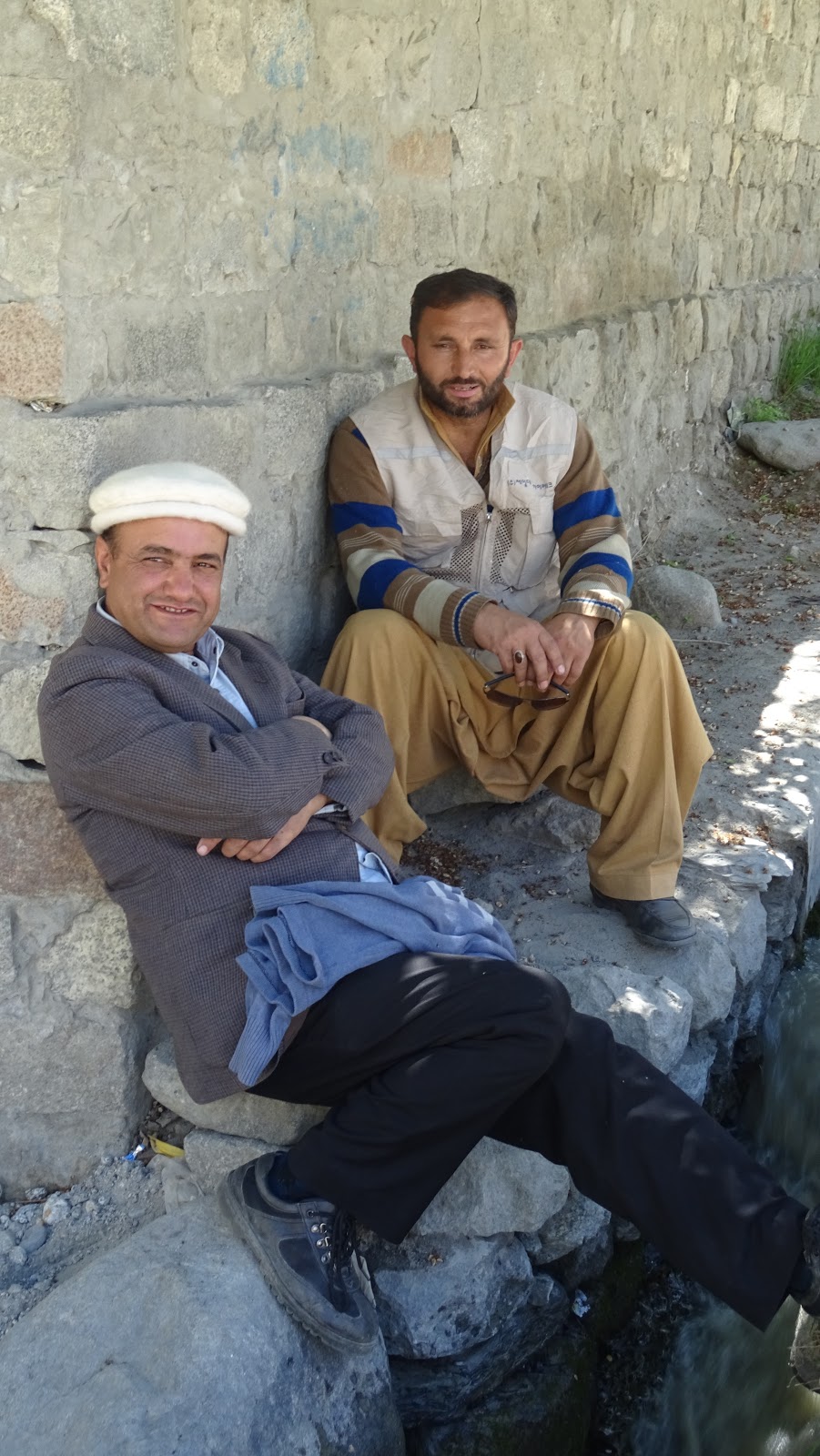
The people of Hunza met while going up to Baltit Fort :
 |
| LOOK AT THE EYES |


 |
| I LOVED THİS LADY AND SPENT QUİTE A LİTTLE BİT OF TİME WİTH HER. |


 |
| THİS MOUSTACHE THİNG MUST BE VERY TOURİSTY SİNCE I HAD SEEN THE SAME İN JAİSALMER - INDİA İN FRONT OF A HAVELİ. |


 |
| WHY SO SAD ? |


 |
| HUNGRY ? WE HAVE SHİSH KEBAB AS WELL AS CHİCKEN. |
 |
| LAST SECTİON OF THE CLİMB - I AM APPROACHİNG BALTİT FORT. |
The Thams (princes) of Hunza abandoned the fort in 1945 and moved to a new palace down the hill, where the present Tham's family is still residing. The fort started to decay and was on the verge of going into ruin when a restoration program was initiated and financed by the Aga Khan Trust for Culture and Historic Cities Support Program. The program was completed in 1996 and the fort is now a museum run by the Baltit Heritage Trust.
In the 15th century, Tham Ayasho II married Princess Shah Khatoon from Baltistan (called Little Tibet in Mughal history) and she brought with her master Balti craftsmen who set to renovate the fort. Baltistan had very strong ethnic and cultural relations with Ladakh to the east. Not surprisingly, the structure of Baltit Fort was influenced by Ladakh/Tibetan architecture and reminds one of the Potala Palace in Lhassa, even if a very tiny Potala.


 |
| THE SUMMER THRONE ON THE ROOF. |

 |
| FROM THE ROOF ONE HAS AN EXTRAORDİNARY VİEW OF THE VALLEY AND THE SURROUNDİNG MOUNTAİNS. |

 |
| ALTİT FORT SEEN FROM ABOVE. I HAVE TO ADMİT I FİRST THOUGHT İT WAS SOMETHİNG LİKE A CEMENT FACTORY. BUT İT DEFİNİTELY İS NOT SO BAD AT ALL WHEN YOU VİSİT İT. |


I have to introduce another interesting peak here Bublimotin, or as is known ''Lady Finger''. İt is 6.000 m high but unlike other peaks it hardly has any snow at its top due to its peculiarly pointed narrow shape.
Just to the right of Lady Finger, Hunza Peak's massive face emerges (6.270 m).


And next to them is Ultar Sar at 7.388 m.

The next morning we proceed to Upper Hunza Valley for a full day excursion to enjoy mountains, glaciers and village life. Let's go.
A little bit down the road we see a magnificent view of Baltit Fort with the mountains behind.
Impossible not to stop and take a picture.

Leaving Karimabad behind, we reach the Nagar Valley and follow the Hunza River making its way through the mountains. Of all the rivers I saw in Pakistan, this one is the bluest.

Half an hour later, a wonder of nature, Attabad Lake comes into view. The huge lake, 100 m deep and spanning over 10 km along the highway, was formed in 2010 in the aftermath of a big tragedy. A massive landslide blocked the river's flow. The natural landslide dam thus created resulted in several villages coming under water and vanishing forever. Loss of life and property was colossal. Later, the river resumed its flow and the landslide dam lake came to be known as Attabad Lake.
Under the sun, the waters of the lake have an unbelievable turquoise color and the surface looks like a huge mirror reflecting surrounding mountains.


When we approach the Upper Hunza Valley, we are welcomed by the Passu Cones (6.106 m) , a succession of dozens of cones like narrow peaks, also known as the Passu Cathedral.


Opposite the Cathedral is the Passu Sar (7.478 m) with the 20,5 km long Passu Glacier that forms its base.


But that is not all. I had a peak dedicated to me here by my good friend Salah. Let me introduce you to ''Tulin's Finger''.


On to Gulmit, the ''capital'' village of Upper Hunza Valley. Before 1974, when Hunza was a princely state, Gulmit used to be the summer capital. Today it is a sleepy little village of 2.500 inhabitants. The people are from the Whaki tribe and are Ismaili like the rest of those in the valley.


A visit to a carpet weaving cooperative where women are active .


 |
| THE PEOPLE OF GULMİT |
 |
| THEY ARE TWİNS GOİNG HOME FROM SCHOOL. |

Back to Karimabad. The next morning we are going to visit Altit Fort. Altit Fort was the original home of the hereditary rulers of Hunza until they moved to the newer Baltit Fort. Some parts of the fort are 1.100 years old (which makes the fort the oldest building in Gilgit-Baltistan province) but additions were made during the 300 years it was used as seat of government.
The Altit Fort was in great disrepair until it was restored by the Aga Khan Trust Fund and opened to the public in 2007.


Within the murals under the fort life goes on :
 |
| VERY İTALİAN TO ME. |
 |
| A REAL BEAUTY |


 |
| PRAY, WHAT COLOR ARE THOSE EYES ? |
 |
| A WOMENS' EDUCATİON CENTER , COURTESY OF THE AGA KHAN FOUNDATİON. |
 |
| SO PROUD OF HİS GRAND SON. |


 |
| AND ALWAYS THE WOMAN AT WORK , EVEN REPAİRİNG THE HOUSE. |


 |
| İT İS ALMOST NİGHT İN THE VALLEY BUT THERE İS STİLL BRİGHT SUNSHİNE ON THE MOUNTAİNS. |
You picture in your mind the first people who settled here and remained hidden for a very long time with mountains and glaciers as their guardian. You picture all the efforts put by climbers to conquer those peaks. You think you are just a tiny peace of rock on this planet and you marvel at what nature can create. You breath, you feel free and you really think you are on the top of the world.
This region is ridiculously beautiful and looking back at my post before publishing it , I realised that pictures do not do justice to those mountains. Just know that if it looks impressive in a picture, it is ten times more so in real life.